Nainital

Nainital

Nainital

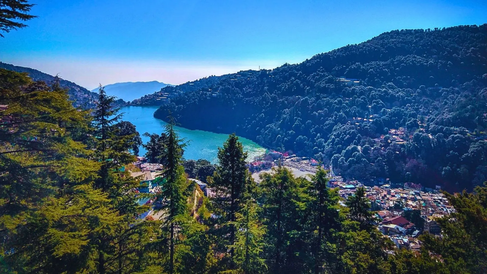
Nainital, famously known as the “Lake District of India,” is a picturesque hill station in Uttarakhand. Surrounded by the majestic Himalayas, it offers serene lakes, lush green hills, and a charming colonial-era ambiance. Ideal for nature lovers, adventure seekers, and families, Nainital promises an unforgettable travel experience.

  • Key Highlights
  • Population:242285(census 2011)
  • Area:7000
  • Altitude:12,887 ft / 3298 m
  • Temperature:Min 15.6`c- Max 40.9`c
  • Season:May to October.
  • Litracy :78%

Sightseeing :

Explore the spiritual, natural, and mythological treasures of Garhwal Himalayas

Nainital Lake:

Also known as Naini Lake,it is situated in the heart of the city and it is owing to this lake that Nainital earned its name. The Pear shaped lake is a tourist paradise. The lake offers holiday makers good opportunity for Yachting, Boating and Paddling. Boating rates for conventional rowing boats and paddle boats are displayed on pre-paid booths at different places along the lake side. Rowing as well as paddle boats are available at both ends of lake.

Naina Devi Temple:

The temple is located on the northern shore of Naini lake. The presiding deity of the temple is Maa Naina Devi. This beautiful temple is a must-visit.

🥾 Land's End:

The main attraction of Land's End is the beautiful view of Khurpatal. Land's End is set at an elevation of 2,120 mts. above sea level offering splendid views of neighboring hills and the green valley with rural houses. In order to reach Land's End one can drive to Barapathar on a vehicle and then trek 1km. to the spot where one feels like the land has come to an end.

🔱 Snow View:

It is the most easily accessible hill top, at a height of 2270 mts. and a distance of 2.5 kms. from the town. The spot is also accessible through a ropeway. Snow view, as the name suggests offers an indescribably beautiful and breathtaking picture of the glittering snow of the Himalayas.

🙏 China Peak:

China peak is situated at a breathtaking altitude of 2611 mts. above sea level, and is the highest point of the town. Located 6 kms. north of Mallital, China peak is also known as Naina peak. This peak offers excellent views of the enchanting snow clad peaks of the mighty Himalayan range and a bird's eye view of the pristine Naini Lake.

🕉️ Tiffin Top:

Located at a distance of 4 kms. from the town, this peak is 2292 mts. above sea level in Ayarpatta region. Tiffin Top commands an excellent view of the Himalayas as well as the neighboring countryside.

How To Reach

By Air: Nearest airport – Pantnagar Airport (70 km)

By Train: Kathgodam Railway Station (34 km)

By Road: Well-connected with buses and taxis from Delhi, Dehradun, and nearby hill stations

Ready to Begin Your Spiritual Journey?

Join thousands of pilgrims who have experienced the divine blessings of Chardham Yatra.